RSS feed source: US National Weather Service

* WHAT…Snow. Additional snow accumulations between 3 and 5 inches. * WHERE…Portions of Central Highlands, Far Eastern, North Woods, and Penobscot Valley Maine * WHEN…Until 4 AM EST Wednesday. * IMPACTS…Plan on slippery road conditions. As winds pick up late Tuesday night be prepared for blowing and drifting snow over area. The hazardous conditions could impact the Tuesday evening and Wednesday morning commutes.

Click this link to continue reading the article on the source website.

RSS feed source: US National Weather Service

Tuesday, Dec 2, 2025 12:00 | By: VN

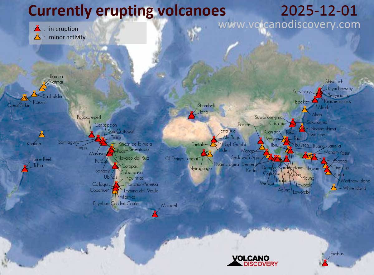
Canlaon (Central Philippines): The Philippine Institute of Volcanology and Seismology (PHIVOLCS) reported that the eruption continued at Kanlaon on 1 December 2025 (local). Plume(s) were reported. The alert level remained at “2 – Moderate Level of Volcanic Unrest” (level 2 on a 0–5 level scale).
Source: Philippine Institute of Volcanology and Seismology (PHIVOLCS)
… [read more]

Taal (Luzon, Philippines): The Philippine Institute of Volcanology and Seismology (PHIVOLCS) reported that the eruption continued at Taal on 1 December 2025 (local). Plume(s) were reported. The alert level remained at “1 – Low-Level Unrest” (on a 0–5 level scale).
Source: Philippine Institute of Volcanology and Seismology (PHIVOLCS)
… [read more]

Karangetang (Siau Island, Sangihe Islands, Indonesia): The Center for Volcanology and Geological Hazard/Pusat Vulkanologi dan Mitigasi Bencana Geologi (CVGHM/PVMBG) reported that the eruption continued at Karangetang on 1 December 2025 (local). The alert

Click this link to continue reading the article on the source website.

RSS feed source: US National Weather Service

Between 6AM and 7AM…a band of light to moderate snow will track north to south over the Interstate 90 corridor. Motorists should be prepared for rapidly changing travel conditions and potential for brief snow accumulations along with reductions in visibility. If traveling, it is advised to slow down for conditions. This will impact I-90 from Warden to Ritzville to Sprague and into Spokane

Click this link to continue reading the article on the source website.

RSS feed source: US National Weather Service

Between 6AM and 7AM…a band of light to moderate snow will track north to south over the Interstate 90 corridor between 6AM and 7AM. Motorist should be prepared for rapidly changing travel conditions with potential for brief snow accumulations and reductions in visibility. If traveling, it is advised to slow down for conditions. This will impact I-90 from Warden to Ritzville to Sprague and into Spokane

Click this link to continue reading the article on the source website.