RSS feed source: US National Weather Service

* WHAT…Flooding caused by excessive rainfall continues. * WHERE…A portion of central California, including the following county, Kern. * WHEN…Until 800 PM PST. * IMPACTS…Minor flooding in low-lying and poor drainage areas. Dangerous flows over low-water crossings. Water over roadways. Overflowing poor drainage areas. * ADDITIONAL DETAILS… – At 617 PM PST, Doppler radar indicated heavy rain. Minor flooding is ongoing or expected to begin shortly in the advisory area. Between 0.2 and 0.5 inches of rain have fallen. – Additional rainfall amounts of 0.2 to 0.7 inches are expected over the area. This additional rain will result in minor flooding. – Some locations that will experience flooding include… Bakersfield, Arvin,

Click this link to continue reading the article on the source website.

RSS feed source: US National Weather Service

* WHAT…Flooding caused by excessive rainfall is expected. * WHERE…A portion of southeast California, including the following county, Inyo. * WHEN…Until 900 PM PST. * IMPACTS…Minor flooding in low-lying and poor drainage areas. Some low-water crossings may become impassable. * ADDITIONAL DETAILS… – At 600 PM PST, Doppler radar indicated heavy rain due to thunderstorms. Minor flooding is ongoing or expected to begin shortly in the advisory area. – Some locations that will experience flooding include… Furnace Creek, Shoshone, Stovepipe Wells, Death Valley Junction, Texas Springs Campground and Tecopa. – http://www.weather.gov/safety/flood

Click this link to continue reading the article on the source website.
RSS feed source: US National Weather Service

Sunday, Nov 16, 2025 00:50 | 49 mins ago | By: EarthquakeMonitor

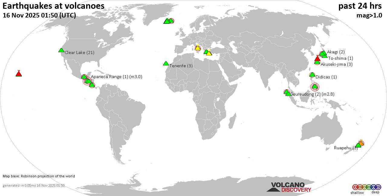
World map showing volcanoes with shallow (less than 50 km) earthquakes within 20 km radius during the past 24 hours on 16 Nov 2025 Number in brackets indicate nr of quakes.

Quakes detected near: Akagi (2 quakes between mag 0.3-1.3), Akuseki-jima (4 quakes between mag 1.1-2.0), Apaneca Range (1 quake mag 3.0), Bardarbunga (7 quakes between mag 0.1-2.8), Campi Flegrei (Phlegrean Fields) (21 quakes between mag 0.1-2.1), Clear Lake (20 quakes between mag 0.2-1.4)
Cuernos de Negros (3 quakes between mag 3.0-3.0), Didicas (1 quake mag 2.2), El Chichón (11 quakes between mag 1.4-3.6), Eldey (8 quakes between mag 1.2-1.7), Geureudong (2 quakes between mag 2.7-2.8), Hrómundartindur (10 quakes between mag 0.1-1.2), Kilauea (3 quakes between mag 1.7-2.4), Kirishima (7 quakes between mag 0.2-1.2), Kolumbo (3 quakes between mag 1.2-2.1), Krísuvík (3 quakes between mag 0.0-1.0), Laguna Aramuaca (1 quake mag 2.0), Ljósufjöll (3 quakes between mag 0.3-1.3), Loihi (1 quake mag 1.7), Methana (1 quake mag 1.3), Nantai (1 quake mag 1.1), Ruapehu (2 quakes between mag 0.8-1.3), Santorini (1 quake mag 1.7), Sinabung (1 quake mag 2.0), Sousaki (1 quake mag 1.2), Suoh (1 quake mag 2.3), Tenerife (3 quakes between mag 1.1-1.5), Tongariro (1 quake mag 1.0), White Island (1 quake mag 2.5), Yake-dake (14 quakes between

Click this link to continue reading the article on the source website.

RSS feed source: US National Weather Service

* WHAT…Flooding caused by excessive rainfall is expected. * WHERE…A portion of southern California, including the following county, San Bernardino. * WHEN…Until 900 PM PST. * IMPACTS…Minor flooding in low-lying and poor drainage areas. Some low-water crossings may become impassable. * ADDITIONAL DETAILS… – At 548 PM PST, Doppler radar indicated heavy rain due to thunderstorms. Minor flooding is ongoing or expected to begin shortly in the advisory area. – Some locations that will experience flooding include… Baker, Sr 127 Near Dumont Dunes, Dumont Dunes, Trona, Homewood Canyon-Valley Wells and Searles Valley. – This includes Interstate 15 in California between mile markers 135 and 166. – http://www.weather.gov/safety/flood

Click this link to continue reading the article on the source website.