Oil Rig
oil-rig-explosion-v2

Emergency Preparedness & Disaster News

We have included this section to help ground resilience theory and concepts in a context of practical applications and current events. Short excerpts are provided from live RSS feeds reporting global emergency preparedness and disaster news. The feeds update every two hours and include the following:

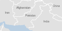
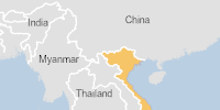
  • Emergency Response: reports from the Global Disaster Alert Organization and the U.S. Environmental Protection Agency.
  • Hazards: reports natural hazards from the NASA Earth Observatory.
  • Earthquakes: reports global earthquakes from the Volcano Discovery website.
  • Transportation: reports from the U.S. National Transportation Safety Board.
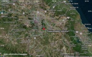
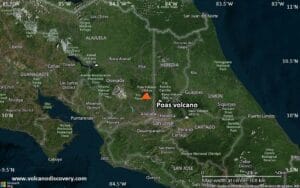
  • Volcanoes: reports global volcano activity from the Volcano Discovery website.
  • Weather: reports from the U.S. National Weather Service.

Scroll the pages and click on the ‘Read More’ link to access more information. This also provides access to a link for the source website. We are continuously updating the disaster news feeds so please contact us to recommend other news sources to include.

Emergency Response

Global Disaster Alert Organization

Green flood alert in Nigeria

Green flood alert in Nigeria

On 17/04/2025, a flood started in Nigeria, lasting until 17/04/2025 (last update). The flood caused 1 deaths and 0 displaced ...
/ Global Disaster Alerts
Green alert for tropical cyclone THIRTYONE-25. Population affected by Category 1 (120 km/h) wind speeds or higher is 0  (0 in Tropical Storm).

Green alert for tropical cyclone THIRTYONE-25. Population affected by Category 1 (120 km/h) wind speeds or higher is 0 (0 in Tropical Storm).

From 18/04/2025 to 18/04/2025, a Tropical Storm (maximum wind speed of 65 km/h) THIRTYONE-25 was active in NTerritory. The cyclone affects these ...
/ Global Disaster Alerts
Green flood alert in Vietnam

Green flood alert in Vietnam

On 12/04/2025, a flood started in Vietnam, lasting until 15/04/2025 (last update). The flood caused 2 deaths and 0 displaced ...
/ Global Disaster Alerts
Loading...

EPA Emergency Response

No posts found.

COVID-19

CDC COVID-19 Updates

Turkana Food Inc. Recalls Aleppo Tahini Sesame Paste 1lb (16oz) Because of Possible Health Risk

Turkana Food Inc. Recalls Aleppo Tahini Sesame Paste 1lb (16oz) Because of Possible Health Risk

Summary Company Announcement Date: February 06, 2025 FDA Publish Date: February 06, 2025 Product Type: Food & Beverages Foodborne Illness Reason for ...
/ Hazards, NASA Natural Hazards

Earthquakes

Global earthquake activity

Moderate mag. 4.0 earthquake - Philippine Sea, 45 km east of Borongan, Philippines, on Saturday, Apr 19, 2025, at 09:56 am (GMT +8)

Moderate mag. 4.0 earthquake – Philippine Sea, 45 km east of Borongan, Philippines, on Saturday, Apr 19, 2025, at 09:56 am (GMT +8)

Date and TimeMagDepthDistanceLocationDetailsMap Apr 13, 02:38 pm (Manila)4.210 km34 km (21 mi) to the SW 33 km southeast of Borongan, Philippines  I FELT IT - ...
/ Global Earthquake Activity
Volcano earthquake report for Saturday, 19 Apr 2025

Volcano earthquake report for Saturday, 19 Apr 2025

Sat, 19 Apr 2025, 01:50 | BY: EARTHQUAKEMONITORWorld map showing volcanoes with shallow (less than 50 km) earthquakes within 20 km radius ...
/ Global Earthquake Activity
Moderate mag. 4.1 earthquake - North Pacific Ocean, 64 km southwest of Ometepec, Guerrero, Mexico, on Friday, Apr 18, 2025, at 06:15 pm (GMT -7)

Moderate mag. 4.1 earthquake – North Pacific Ocean, 64 km southwest of Ometepec, Guerrero, Mexico, on Friday, Apr 18, 2025, at 06:15 pm (GMT -7)

Date and TimeMagDepthDistanceLocationDetailsMap Apr 18, 01:25 pm (GMT -7)4.25 km2.8 km (1.7 mi) to the W North Pacific Ocean, 66 km southwest of Ometepec, Guerrero, ...
/ Global Earthquake Activity
Moderate mag. 4.4 earthquake - South Pacific Ocean, Hawke's Bay, 174 km west of Raoul Island, New Zealand, on Saturday, Apr 19, 2025, at 01:15 pm (GMT +12)

Moderate mag. 4.4 earthquake – South Pacific Ocean, Hawke’s Bay, 174 km west of Raoul Island, New Zealand, on Saturday, Apr 19, 2025, at 01:15 pm (GMT +12)

Date and TimeMagDepthDistanceLocationDetailsMap Apr 11, 03:11 am (GMT +12)4.2303 km76 km (47 mi) to the SE New Zealand InfoMar 25, 09:35 am (GMT +13)4.1240 km96 km (60 mi) ...
/ Global Earthquake Activity
World Earthquake Report for Friday, 18 April 2025

World Earthquake Report for Friday, 18 April 2025

Sat, 19 Apr 2025, 00:24 | BY: EARTHQUAKEMONITORWorldwide earthquakes above magnitude 3 during the past 24 hours on 19 Apr 2025Summary: 8 ...
/ Global Earthquake Activity
Light mag. 3.9 earthquake - Banda Sea, 99 km northwest of Ambon, Ambon, Maluku, Indonesia, on Saturday, Apr 19, 2025, at 08:58 am (GMT +9)

Light mag. 3.9 earthquake – Banda Sea, 99 km northwest of Ambon, Ambon, Maluku, Indonesia, on Saturday, Apr 19, 2025, at 08:58 am (GMT +9)

Support us - Help us upgrade our services! We truly love working to bring you the latest volcano and earthquake data from ...
/ Global Earthquake Activity

Nuclear

International Atomic Energy Agency – Event Notices

IAEA Nuclear Event Notices

Radiactive Waste Facility Taken Over

Radiactive Waste Facility Taken Over Print View Posted on: 19 March 2025 Event Date: 02 March 2025 Event Type: Radiation Waste Facility ...
/ Hazards, IAEA
IAEA Nuclear Event Notices

Lost Radiography Device

Lost Radiography Device Print View Posted on: 19 March 2025 Event Date: 06 March 2025 Event Type: Radiation Source Event Location: United ...
/ Hazards, IAEA
IAEA Nuclear Event Notices

Lost Radiography Device

Lost Radiography Device Print View Posted on: 13 March 2025 Event Date: 06 March 2025 Event Type: Radiation Source Event Location: United ...
/ Hazards, IAEA
IAEA Nuclear Event Notices

Stolen Radiography Camera

Stolen Radiography Camera Print View Posted on: 07 March 2025 Event Date: 27 February 2025 Event Type: Radiation Source Event Location: United ...
/ Hazards, IAEA
IAEA Nuclear Event Notices

Radiactive Waste Facility Taken Over

Radiactive Waste Facility Taken Over Print View Posted on: 03 March 2025 Event Date: 02 March 2025 Event Type: Radiation Source Event ...
/ Hazards, IAEA
IAEA Nuclear Event Notices

Accidential Exposure of Industrial Radiography Worker

Accidential Exposure of Industrial Radiography Worker Print View Posted on: 26 December 2024 Event Date: 12 September 2023 Event Type: Radiation Source ...
/ Hazards, IAEA

Transportation

NTSB Accident Investigations

No posts found.

Volcanos

Global Volcano Activity

Popocatépetl Volcano Volcanic Ash Advisory: DISCRETE VA EM. to 22000 ft (6700 m)

Popocatépetl Volcano Volcanic Ash Advisory: DISCRETE VA EM. to 22000 ft (6700 m)

Background:Volcán Popocatépetl, whose name is the Aztec word for smoking mountain, towers to 5426 m 70 km SE of Mexico City to ...
Volcanoes Today, 19 Apr 2025: Ibu volcano, Marapi, Reventador, Poas

Volcanoes Today, 19 Apr 2025: Ibu volcano, Marapi, Reventador, Poas

Support us - Help us upgrade our services! We truly love working to bring you the latest volcano and earthquake data from ...
Volcanoes Today, 19 Apr 2025: Ibu volcano, Marapi, Reventador, Poas

Volcanoes Today, 19 Apr 2025: Ibu volcano, Marapi, Reventador, Poas

Support us - Help us upgrade our services! We truly love working to bring you the latest volcano and earthquake data from ...
Poas Volcano Volcanic Ash Advisory: PSBL VA EMS. to 10000 ft (3000 m)

Poas Volcano Volcanic Ash Advisory: PSBL VA EMS. to 10000 ft (3000 m)

<!--div style="font-size:14px;text-align:center;border:3px solid blue;border-radius:5px;padding:3px;margin:5px;background:#eee"><a href="https://www.volcanoesandearthquakes.com/app/volcano-report.php?volcanoId=114" style="text-decoration:none" target="_blank" rel="noopener noreferrer nofollow" title="Share a volcano (activity) report, submit a photo or other interesting news!" ...
Poas Volcano Volcanic Ash Advisory: PSBL VA EMS. to 10000 ft (3000 m)

Poas Volcano Volcanic Ash Advisory: PSBL VA EMS. to 10000 ft (3000 m)

<!--div style="font-size:14px;text-align:center;border:3px solid blue;border-radius:5px;padding:3px;margin:5px;background:#eee"><a href="https://www.volcanoesandearthquakes.com/app/volcano-report.php?volcanoId=114" style="text-decoration:none" target="_blank" rel="noopener noreferrer nofollow" title="Share a volcano (activity) report, submit a photo or other interesting news!" ...
Marapi Volcano Volcanic Ash Advisory: VA TO FL140 OBS AT 18/2320Z MOV SSW OBS VA DTG: 18/2320Z to 14000 ft (4300 m)

Marapi Volcano Volcanic Ash Advisory: VA TO FL140 OBS AT 18/2320Z MOV SSW OBS VA DTG: 18/2320Z to 14000 ft (4300 m)

<!--div style="font-size:14px;text-align:center;border:3px solid blue;border-radius:5px;padding:3px;margin:5px;background:#eee"><a href="https://www.volcanoesandearthquakes.com/app/volcano-report.php?volcanoId=62" style="text-decoration:none" target="_blank" rel="noopener noreferrer nofollow" title="Share a volcano (activity) report, submit a photo or other interesting news!" ...

Weather

National Weather Service

Special Weather Statement issued April 18 at 9:31PM CDT by NWS Fort Worth TX

Special Weather Statement issued April 18 at 9:31PM CDT by NWS Fort Worth TX

At 930 PM CDT, Doppler radar was tracking a strong thunderstorm near Newport, or 12 miles west of Bowie, moving northeast at ...
/ National Weather Service
Severe Thunderstorm Warning issued April 18 at 10:31PM EDT until April 18 at 11:00PM EDT by NWS Gaylord MI

Severe Thunderstorm Warning issued April 18 at 10:31PM EDT until April 18 at 11:00PM EDT by NWS Gaylord MI

At 1030 PM EDT, a severe thunderstorm was located over Cadillac, moving northeast at 55 mph. HAZARD...60 mph wind gusts and quarter ...
/ National Weather Service
Severe Thunderstorm Warning issued April 18 at 9:26PM CDT until April 18 at 10:15PM CDT by NWS Norman OK

Severe Thunderstorm Warning issued April 18 at 9:26PM CDT until April 18 at 10:15PM CDT by NWS Norman OK

SVROUN The National Weather Service in Norman has issued a * Severe Thunderstorm Warning for... Southern Seminole County in east central Oklahoma ...
/ National Weather Service
Flood Warning issued April 18 at 9:24PM CDT until April 22 at 7:32AM CDT by NWS Paducah KY

Flood Warning issued April 18 at 9:24PM CDT until April 22 at 7:32AM CDT by NWS Paducah KY

...The Flood Warning continues for the following rivers in Illinois...Kentucky...Missouri... Ohio River at Paducah affecting Massac, Livingston, McCracken and Pope Counties. Ohio ...
/ National Weather Service
Flood Warning issued April 18 at 9:24PM CDT until April 23 at 4:00PM CDT by NWS Paducah KY

Flood Warning issued April 18 at 9:24PM CDT until April 23 at 4:00PM CDT by NWS Paducah KY

...The Flood Warning continues for the following rivers in Illinois...Kentucky...Missouri... Ohio River at Paducah affecting Massac, Livingston, McCracken and Pope Counties. Ohio ...
/ National Weather Service
Flood Warning issued April 18 at 9:24PM CDT until April 23 at 5:00PM CDT by NWS Paducah KY

Flood Warning issued April 18 at 9:24PM CDT until April 23 at 5:00PM CDT by NWS Paducah KY

...The Flood Warning continues for the following rivers in Illinois...Kentucky...Missouri... Ohio River at Paducah affecting Massac, Livingston, McCracken and Pope Counties. Ohio ...
/ National Weather Service