RSS feed source: Volcano Discovery.com

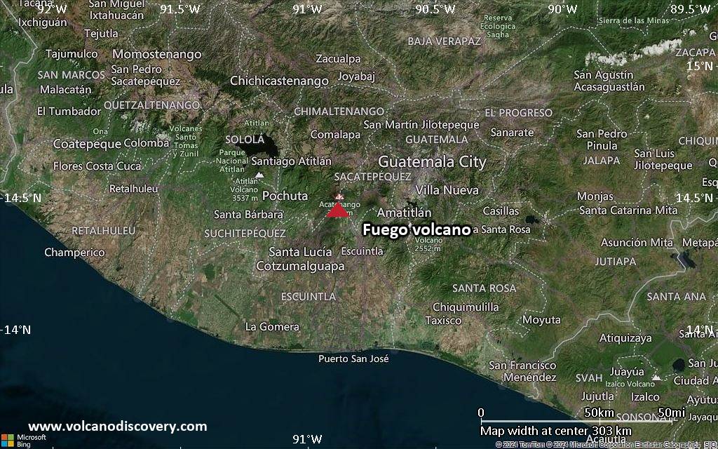
<!–div style="font-size:14px;text-align:center;border:3px solid blue;border-radius:5px;padding:3px;margin:5px;background:#eee"><a href="https://www.volcanoesandearthquakes.com/app/volcano-report.php?volcanoId=26" style="text-decoration:none" target="_blank" rel="noopener noreferrer nofollow" title="Share a volcano (activity) report, submit a photo or other interesting news!” onclick=”window.open(this.href,’Volcano Report’,’status=0,toolbar=0,location=0,directories=0,menubar=0,resizable=1,scrollbars=1,height=500,width=450′);return false”>Send Volcano Report</div–> Stratovolcano 3,763 m / 12,346 ft
Guatemala, 14.47°N / -90.88°W
Current status: erupting (4 out of 5) Fuego volcano eruptions:
1581, 1585, 1586, 1587, 1614, 1617, 1620, 1623, 1629, 1679(?), 1685, 1686, 1689(?), 1699, 1702, 1705, 1706, 1709(?), 1710,1717,1730, 1732, 1737, 1751(?), 1765(?), 1773(?), 1799, 1826, 1829, 1850(?), 1852(?), 1855, 1856, 1857, 1860, 1861(?), 1867(?), 1880, 1896, 1932, 1944, 1949, 1953, 1955, 1957, 1962, 1963, 1966, 1967, 1971, 1973, 1974, 1975, 1977, 1987, 1999, 2002 – ongoing
Typical eruption style
Dominantly explosive, construction of lava domes and extrusion of viscous lava flows. In near constant activity, at least during the past centuries.

Click this link to continue reading the article on the source website.
RSS feed source: Volcano Discovery.com

<!–div style="font-size:14px;text-align:center;border:3px solid blue;border-radius:5px;padding:3px;margin:5px;background:#eee"><a href="https://www.volcanoesandearthquakes.com/app/volcano-report.php?volcanoId=44" style="text-decoration:none" target="_blank" rel="noopener noreferrer nofollow" title="Share a volcano (activity) report, submit a photo or other interesting news!” onclick=”window.open(this.href,’Volcano Report’,’status=0,toolbar=0,location=0,directories=0,menubar=0,resizable=1,scrollbars=1,height=500,width=450′);return false”>Send Volcano Report</div–> Stratovolcano 3676 m (12,060 ft)
East Java, Indonesia, -8.11°S / 112.92°E
Current status: erupting (4 out of 5) Semeru volcano eruptions:
1818, 1829, 1830, 1832, 1836, 1838, 1842, 1844, 1845, 1848, 1849(?), 1851, 1856, 1857, 1865, 1866(?), 1887, 1887, 1888, 1889-91, 1892, 1893, 1893-94, 1895, 1896, 1897, 1899, 1899, 1900, 1901, 1903, 1904, 1905, 1907, 1908, 1909-10, 1910-11, 1911, 1912, 1913, 1941-42, 1945, 1946, 1946-47, 1950-64, 1967-ongoing
Typical eruption style
Explosive. Near constant strombolian activity, occasionally stronger explosions, lava flows and pyroclastic flows.

Click this link to continue reading the article on the source website.

RSS feed source: Volcano Discovery.com

Date and TimeMag
DepthDistanceLocationDetailsMap Aug 26, 05:39 am (GMT -6)

4.4

3.3 km12 km (7.6 mi) to the NE North Pacific Ocean, 107 km southwest of Mapastepec, Estado de Chiapas, MexicoI FELT IT InfoAug 24, 05:26 pm (GMT -6)

4.1

16 km92 km (57 mi) to the SW North Pacific Ocean, MexicoI FELT IT InfoAug 24, 04:29 pm (GMT -6)

4.0

16 km9 km (5.6 mi) to the W North Pacific Ocean, 152 km south of Tonala, Estado de Chiapas, MexicoI FELT IT InfoAug 24, 04:28 pm (GMT -6)

4.0

15 km20 km (13 mi) to the NW North Pacific Ocean, 146 km south of Tonala, Estado de Chiapas, MexicoI FELT IT InfoAug 23, 04:55 pm (GMT -6)

4.1

16 km64 km (40 mi) to the W North Pacific Ocean, 168 km southwest of Pijijiapan, Estado de Chiapas, MexicoI FELT IT InfoAug 10, 08:21 pm (GMT -6)

5.8

9.1 km75 km (47 mi) to the W North Pacific Ocean, 250 km southwest of Tuxtla, Estado de Chiapas, Mexico 1 reportInfoJun 18, 03:49 am (GMT -6)

5.8

10 km34 km (21 mi) to the W 115 km SW of El Palmarcito, Mexico 6 reportsInfoJul 14, 2023 03:29 am (GMT -6)

6.5

16 km49 km (30 mi) to the W Mexico: 140 Km Al SUROESTE De PIJIJIAPAN, CHIS 114 reportsInfoJun 23, 2020 03:29 pm (Universal Time)

7.1

10 km284 km (176 mi) to the NW 62 km west of Salina Cruz, Estado de Oaxaca, Mexico 469 reportsInfoNov 19, 2019 10:27 pm (GMT -6)

6.2

10 km98 km (61 mi) to the SE North Pacific Ocean, 98 km southwest of Brisas

Click this link to continue reading the article on the source website.

RSS feed source: Volcano Discovery.com

Both Disaster Recovery Centers will remain open until further notice. 

ST. LOUIS – The deadline to apply for FEMA Individual Assistance is drawing near for Missouri residents affected by the May 16 disaster

If your home or personal property sustained damage not covered by insurance, FEMA may be able to provide money to help you pay for home repairs, a temporary place to live and replace essential personal property that was destroyed.

The fastest way to apply for Individual Assistance is at DisasterAssistance.gov. You may also apply by calling FEMA at 1-800-621-3362 or visiting a Disaster Recovery Center. The deadline to apply for FEMA Individual Assistance is August 26, 2025.

Disaster Recovery Centers

Two Disaster Recovery Centers are still open in St. Louis City with FEMA and U.S. Small Business Administration staff helping impacted residents with their disaster assistance applications, answering questions, and uploading required documents.

LOCATIONSHOURS OF OPERATION

Urban League Entrepreneurship and Women’s Business Center 

4401 Natural Bridge Ave.
St. Louis, MO 63115

Monday-Friday: 8 a.m.-7 p.m.
Saturday: 9 a.m.-4 p.m.
Sunday: Closed

Closed on Labor Day

Union Tabernacle M.B. Church

 N Newstead Ave.

St. Louis, MO 63108

Monday-Friday: 8 a.m.-7 p.m.
Saturday and Sunday: Closed

Closed on Labor Day

You can still ask for additional assistance, as long as you submit an initial application before the deadline.

Click this link to continue reading the article on the source website.