RSS feed source: US National Weather Service

* WHAT…Flooding caused by excessive rainfall is expected. * WHERE…A portion of south Texas, including the following county, Webb. * WHEN…Until 930 PM CST. * IMPACTS…Minor flooding in low-lying and poor drainage areas. * ADDITIONAL DETAILS… – At 627 PM CST, Doppler radar indicated heavy rain due to thunderstorms. Minor flooding is ongoing or expected to begin shortly in the advisory area. Between 2 and 2.5 inches of rain have fallen. – Additional rainfall amounts of 1 to 2 inches are expected over the area. This additional rain will result in minor flooding. – Some locations that will experience flooding include… mainly rural areas of Southeastern Webb County – http://www.weather.gov/safety/flood

Click this link to continue reading the article on the source website.

RSS feed source: US National Weather Service

Date and TimeMag
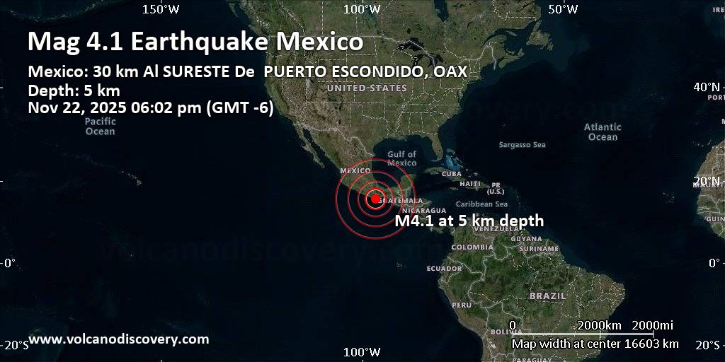
DepthDistanceLocationDetailsMap Nov 22, 06:02 pm (Mexico City)

4.1

5 km2.6 km (1.6 mi) to the N 30 km southeast of Puerto Escondido, Estado de Oaxaca, MexicoI FELT IT InfoNov 19, 08:34 am (Mexico City)

4.0

16 km95 km (59 mi) to the W 54 km southeast of Pinotepa Nacional, Estado de Oaxaca, MexicoI FELT IT1 reportInfoNov 18, 10:36 pm (Mexico City)

4.0

7.8 km37 km (23 mi) to the W North Pacific Ocean, 19 km southwest of Puerto Escondido, MexicoI FELT IT InfoNov 16, 02:45 am (Mexico City)

4.0

5 km37 km (23 mi) to the SE North Pacific Ocean, 51 km southwest of Crucecita, Estado de Oaxaca, MexicoI FELT IT InfoNov 16, 02:37 am (Mexico City)

4.1

5 km31 km (19 mi) to the SE North Pacific Ocean, 61 km southeast of Puerto Escondido, MexicoI FELT IT InfoAug 28, 2023 04:32 pm (Mexico City)

4.9

50 km95 km (59 mi) to the NE 28 km northeast of Miahuatlan de Porfirio Diaz, Estado de Oaxaca, Mexico 13 reportsInfoJun 15, 2023 08:03 pm (GMT -6)

5.1

16 km46 km (29 mi) to the SE North Pacific Ocean, 56 km southwest of Crucecita, Estado de Oaxaca, Mexico 34 reportsInfoApr 3, 2023 08:11 pm (Mexico City)

5.4

31 km43 km (27 mi) to the NW Near Mexico, Ciudad de México, Mexico 149 reportsInfoMar 1, 2022 01:35 pm (Mexico City)

5.2

41 km33 km (21 mi) to the NE Mexico: 26 Km Al NOROESTE De S PEDRO POCHUTLA, OAX 148 reportsInfoDec 5, 2021 06:20 pm (Mexico City)

5.1

9 km80 km (50 mi) to the E North

Click this link to continue reading the article on the source website.

RSS feed source: US National Weather Service

4 km (3 mi)

E of epicenter

Guapinole

(pop: 212)

V: Moderate

Santa Maria Tonameca, Estado de Oaxaca 12 km (7 mi)

W of epicenter

El Tomatal

(pop: 628)

IV: Light

Santa Maria Colotepec, Estado de Oaxaca 13 km (8 mi)

NE of epicenter

San Francisco Cozoaltepec

(pop: 2,120)

IV: Light

Santa Maria Tonameca, Estado de Oaxaca 14 km (9 mi)

N of epicenter

Mata de Bule

(pop: 293)

IV: Light

Santa Maria Colotepec, Estado de Oaxaca 21 km (13 mi)

NW of epicenter

Santa Maria Colotepec

(pop: 1,370)

III: Weak

Santa Maria Colotepec, Estado de Oaxaca 22 km (14 mi)

E of epicenter

San Isidro del Palmar

(pop: 807)

III: Weak

Santa Maria Tonameca, Estado de Oaxaca 26 km (16 mi)

NE of epicenter

San Jose Piedras Negras

(pop: 1,140)

III: Weak

Santo Domingo de Morelos, Estado de Oaxaca 27 km (17 mi)

NE of epicenter

San Bartolome Loxicha

(pop: 1,410)

III: Weak

San Bartolome Loxicha, Estado de Oaxaca 30 km (18 mi)

NW of epicenter

Puerto Escondido

(pop: 29,900)

III: Weak

San Pedro Mixtepec -Dto. 22 –, Estado de Oaxaca 33 km (20 mi)

N of epicenter

San Jose Llano Cieneguilla

(pop: 972)

III: Weak

San Sebastian Coatlan, Estado de Oaxaca 36 km (23 mi)

N of epicenter

Santa Catarina Loxicha

(pop:

Click this link to continue reading the article on the source website.