RSS feed source: US National Weather Service

* IMPACTS…Abundant lightning on dry fuels resulting in the potential for numerous new fire starts. * AFFECTED AREA…In California, all of Fire weather zones 280, 281, 284, and 285, and in Oregon, all of Fire weather zones 621, 623, 624, and 625. * THUNDERSTORMS…Scattered thunderstorms with abundant lightning are expected. Storms are likely to be wet, but lightning strikes outside of precipitation cores are possible, and may cause many new fire starts. * OUTFLOW WINDS…Gusts of 35 to 50 mph could travel outward up to 25 miles from thunderstorm cores. * DETAILED URL…View the hazard area in detail at https://www.wrh.noaa.gov/map/?wfo=mfr

Click this link to continue reading the article on the source website.

RSS feed source: US National Weather Service

Date and TimeMag
DepthDistanceLocationDetailsMap Aug 23, 10:47 am (GMT -6)

4.3

53 km34 km (21 mi) to the N 62 km SW of Puerto Madero, Mexico  I FELT IT InfoAug 23, 12:37 am (GMT -6)

3.6

17 km70 km (44 mi) to the NW Offshore Chiapas, Mexico  I FELT IT

Info

Aug 21, 03:37 am (GMT -6)

4.0

87 km99 km (62 mi) to the N 26 km west of Tapachula, Estado de Chiapas, MexicoI FELT IT InfoAug 20, 03:03 pm (GMT -6)

4.0

12 km29 km (18 mi) to the E North Pacific Ocean, 75 km west of Champerico, GuatemalaI FELT IT InfoAug 20, 02:59 am (GMT -6)

4.0

10 km20 km (13 mi) to the SW Off Coast of Chiapas, Mexico  I FELT IT InfoAug 20, 12:29 am (GMT -6)

4.2

13 km70 km (44 mi) to the S North Pacific Ocean, 162 km southwest of Retalhuleu, GuatemalaI FELT IT InfoMay 12, 2024 05:39 am (GMT -6)

6.2

10 km28 km (17 mi) to the NE Mexico: 76 km al SUROESTE de CD HIDALGO, CHIS 312 reportsInfoNov 19, 2019 10:27 pm (GMT -6)

6.2

10 km24 km (15 mi) to the NW North Pacific Ocean, 98 km southwest of Brisas Barra de Suchiate, Mexico 44 reportsInfoFeb 1, 2019 10:19 am (Mexico City)

6.7

0 km83 km (52 mi) to the NE North Pacific Ocean, 33 km southwest of Tapachula, Estado de Chiapas, Mexico InfoSep 7, 2017 10:49 pm (GMT -6)

8.0

60 km151 km (94 mi) to the NW North Pacific Ocean, 87 km southwest of Topon, Estado de Chiapas, Mexico 317 reportsInfoApr 15, 2016 08:11 am (GMT -6)

6.0

10 km91 km

Click this link to continue reading the article on the source website.

RSS feed source: US National Weather Service

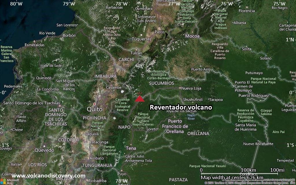
Sun, 24 Aug 2025, 10:30 | BY: VN

Explosive activity continues. Volcanic Ash Advisory Center (VAAC) Washington warned about a volcanic ash plume that rose up to estimated 15000 ft (4600 m) altitude or flight level 150 .
The full report is as follows:

FVXX20 at 10:25 UTC, 24/08/25 from KNES
VA ADVISORY
DTG: 20250824/1022Z

VAAC: WASHINGTON

VOLCANO: REVENTADOR 352010
PSN: S0005 W07739

AREA: ECUADOR

SUMMIT ELEV: 11686 FT [3562 M]

ADVISORY NR: 2025/810

INFO SOURCE: GOES-19. WEBCAM. NWP MODELS.

ERUPTION DETAILS: ONGOING VA EMS

OBS VA DTG: 24/0950Z

OBS VA CLD: SFC/FL150 N0001 W07750 – S0004 W07739
– S0005 W07739 – S0003 W07752 – N0001 W07750 MOV
NW 10KT

FCST VA CLD +6HR: 24/1600Z SFC/FL150 N0003 W07758
– S0004 W07740 – S0005 W07739 – S0002 W07759 –
N0003 W07758

FCST VA CLD +12HR: 24/2200Z SFC/FL150 N0004
W07756 – S0004 W07739 – S0005 W07739 – S0002
W07759 – N0004 W07756

FCST VA CLD +18HR: 25/0400Z SFC/FL150 N0003
W07757 – S0004 W07739 – S0005 W07739

Click this link to continue reading the article on the source website.
RSS feed source: US National Weather Service

* WHAT…Breaking waves of 3 to 4 ft will result in rough surf conditions and a high risk of rip currents. * WHERE…In Maryland, Maryland Beaches County. In North Carolina, Eastern Currituck County. In Virginia, Virginia Beach. * WHEN…Through this evening. * IMPACTS…Dangerous swimming and surfing conditions and localized beach erosion. Rip currents can sweep even the best swimmers away from shore into deeper water. Dangerous shore break can throw a swimmer or surfer head first into the bottom causing neck and back injuries.

Click this link to continue reading the article on the source website.