RSS feed source: USGS Earthquake Hazards Program
Time2026-10-29 03:17:54 UTC2026-10-29 03:17:54 UTC at epicenterLocation8.370°N 127.443°EDepth10.00 km (6.21 mi)
Click this link to continue reading the article on the source website.
RSS feed source: USGS Earthquake Hazards Program
Time2026-10-29 03:17:54 UTC2026-10-29 03:17:54 UTC at epicenterLocation8.370°N 127.443°EDepth10.00 km (6.21 mi)
Click this link to continue reading the article on the source website.
RSS feed source: USGS Earthquake Hazards Program
On 10/29/2026 3:19:05 AM, an earthquake occurred in Philippines potentially affecting 7 thousand in MMI IV. The earthquake had Magnitude 5.8M, Depth:10km.
Click this link to continue reading the article on the source website.
RSS feed source: USGS Earthquake Hazards Program
PAGER – GREEN ShakeMap – V DYFI? – IV
Time2026-10-28 15:07:52 UTC2026-10-28 15:07:52 UTC at epicenterLocation35.702°N 140.706°EDepth41.36 km (25.70 mi)
Click this link to continue reading the article on the source website.
RSS feed source: USGS Earthquake Hazards Program
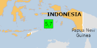
On 10/28/2026 10:06:44 PM, an earthquake occurred in Indonesia potentially affecting Few people affected in MMI III. The earthquake had Magnitude 5.7M, Depth:128.068km.
Click this link to continue reading the article on the source website.