Friday, Jan 2, 2026 14:07 | 18 mins ago | By: EarthquakeMonitor
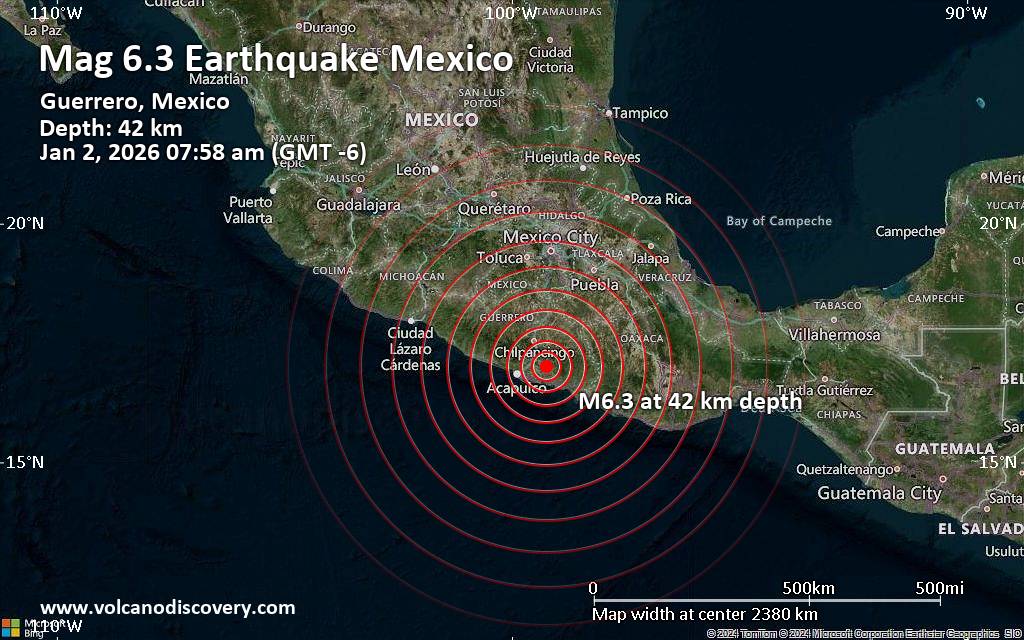
A magnitude 6.3 earthquake near Chilpancingo, Chilpancingo de los Bravo Municipality, Estado de Guerrero, Mexico, was reported only 8 minutes ago by the European-Mediterranean Seismological Centre (EMSC), considered one of the key international agencies that monitor seismic activity worldwide. The earthquake occurred at a moderately shallow depth of 42. km beneath the epicenter in the morning on Friday, January 2nd, 2026, at 7:58 am local time. The exact magnitude, epicenter, and depth of the quake might be revised within the next few hours or minutes as seismologists review data and refine their calculations, or as other agencies issue their report.
A second report was later issued by France’s Réseau National de Surveillance Sismique (RéNaSS), which listed it as a magnitude 5.5 earthquake. A third agency, the German Research Centre for Geosciences (GFZ), reported the same quake at magnitude 6.2.
Based on the preliminary seismic data, the quake was probably felt by many people in the area of the epicenter. It should not have caused significant damage, other than objects falling from shelves, broken windows, etc.
In Tixtla de Guerrero (pop. 22,800) located 62 km from the epicenter, Chilapa de Alvarez (pop. 31,200) 63 km away, Chilpancingo (pop. 187,300) 64 km away, Acapulco de Juárez (pop. 658,600) 75 km away, Zumpango del


