RSS feed source: USGS Earthquake Hazards Program
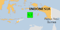
Time2026-10-28 22:06:44 UTC2026-10-28 22:06:44 UTC at epicenterLocation6.396°S 130.376°EDepth128.07 km (79.58 mi)
Click this link to continue reading the article on the source website.
RSS feed source: USGS Earthquake Hazards Program
Time2026-10-28 22:06:44 UTC2026-10-28 22:06:44 UTC at epicenterLocation6.396°S 130.376°EDepth128.07 km (79.58 mi)
Click this link to continue reading the article on the source website.
RSS feed source: USGS Earthquake Hazards Program
On 10/28/2026 10:06:44 PM, an earthquake occurred in Indonesia potentially affecting Few people affected in MMI III. The earthquake had Magnitude 5.7M, Depth:128.068km.
Click this link to continue reading the article on the source website.
RSS feed source: USGS Earthquake Hazards Program
Time2026-10-28 18:44:30 UTC2026-10-28 18:44:30 UTC at epicenterLocation57.961°N 32.202°WDepth10.00 km (6.21 mi)
Click this link to continue reading the article on the source website.
RSS feed source: USGS Earthquake Hazards Program
Time2026-10-28 18:32:23 UTC2026-10-28 18:32:23 UTC at epicenterLocation35.776°N 140.646°EDepth41.49 km (25.78 mi)
Click this link to continue reading the article on the source website.