RSS feed source: Volcano Discovery.com--Global earthquake monitor
Date and TimeMag
DepthDistanceLocationDetailsMap Aug 12, 05:51 pm (GMT +9)
4.0
10 km19 km (12 mi) to the NE South Pacific Ocean, 194 km northwest of Jayapura, Indonesia I FELT IT InfoAug 12, 05:44 pm (GMT +9)
4.4
10 km11 km (6.9 mi) to the NE South Pacific Ocean, 195 km northwest of Jayapura, Indonesia I FELT IT InfoAug 12, 05:24 pm (Jayapura)
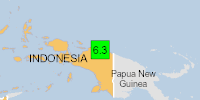
6.4
38 km45 km (28 mi) to the SW Kabupaten Sarmi, South Papua, 204 km west of Jayapura, Indonesia I FELT IT – 1 reportInfoAug 10, 09:06 pm (Jayapura)
4.1
24 km91 km (56 mi) to the W Kabupaten Mamberamo Raya, South Papua, 275 km west of Jayapura, Indonesia I FELT IT InfoAug 10, 03:37 am (GMT +9)
3.7
11 km65 km (40 mi) to the NW South Pacific Ocean, 252 km northwest of Jayapura, Indonesia I FELT IT – 1 report
Info
Aug 3, 09:57 pm (GMT +9)
4.0
12 km18 km (11 mi) to the N South Pacific Ocean, 204 km northwest of Jayapura, Indonesia I FELT IT InfoSep 10, 2022 08:31 am (Jayapura)
5.9
106 km87 km (54 mi) to the W Kabupaten Sarmi, South Papua, 273 km west of Jayapura, Indonesia InfoJun 20, 2019 02:24 am (Jayapura)
6.2
18 km77 km (48 mi) to the SW Kabupaten Sarmi, South Papua, 257 km west of Jayapura, Indonesia InfoApr 6, 2013 01:42 pm (Jayapura)
7.0
66 km198 km (123 mi) to the S Kabupaten Tolikara, South Papua, 272 km southwest of Jayapura, Indonesia 2 reportsInfoNov 16, 2010 10:39 am (Jayapura)
5.9
13 km18 km (11 mi) to the S Kabupaten Sarmi, South Papua, 198 km west of Jayapura, Indonesia InfoJul
Click this link to continue reading the article on the source website.