RSS feed source: Volcano Discovery.com--Global earthquake monitor

Date and TimeMag
DepthDistanceLocationDetailsMap Jul 13, 08:49 am (GMT +8)

4.2

10 km75 km (47 mi) to the SE Indian Ocean, 151 km south of Lombok Island, West Nusa Tenggara, Indonesia InfoJul 3, 09:34 am (GMT +8)

4.2

23 km84 km (52 mi) to the E Indian Ocean, 88 km south of Taliwang, Indonesia InfoMar 13, 12:32 am (GMT +8)

4.3

24 km15 km (9.5 mi) to the W Indian Ocean, 78 km south of Praya, Indonesia 45 reportsInfoJan 8, 10:59 pm (GMT +7)

4.5

26 km85 km (53 mi) to the W Indian Ocean, 95 km southeast of Kuta, Indonesia 45 reportsInfoDec 10, 2024 05:31 pm (Makassar)

4.2

92 km71 km (44 mi) to the N Kabupaten Lombok Tengah, 26 km south of Mataram, Indonesia 1 reportInfoAug 29, 2023 03:55 am (Makassar)

7.1

525 km280 km (174 mi) to the N Java Sea, 86 km east of Pulau Sepanjang Island, Jawa Timur, Indonesia 2473 reportsInfoAug 22, 2022 03:36 pm (Jakarta)

5.4

128 km85 km (53 mi) to the NW Indian Ocean, 61 km southeast of Denpasar, Indonesia 1384 reportsInfoSep 19, 2009 06:06 am (GMT +7)

5.7

79 km82 km (51 mi) to the NW south of Bali, Indonesia InfoSep 2, 2004 02:38 am (Makassar)

5.5

107 km98 km (61 mi) to the NW Bali Region, Indonesia InfoAug 8, 2004 02:52 am (Makassar)

5.4

109 km90 km (56 mi) to the N Bali Sea, 30 km west of Lombok Island, West Nusa Tenggara, Indonesia InfoJun 26, 2004 04:34 am (Makassar)

5.5

116 km86 km (53 mi) to the N Kabupaten Lombok Tengah, 14 km southeast of Mataram, Indonesia InfoMay 17, 2004 03:17 am (GMT +8)

5.4

2 km35 km (22 mi) to the

Click this link to continue reading the article on the source website.

RSS feed source: Volcano Discovery.com--Global earthquake monitor

Thu, 28 Aug 2025, 19:07 | BY: EARTHQUAKEMONITOR

A very shallow magnitude 2.8 earthquake was reported early morning near Merredin, Western Australia, Australia.
According to Geoscience Australia (GeoAu), the quake hit on Friday, August 29th, 2025, at 2:39 am local time at a very shallow depth of 0.4 miles. Shallow earthquakes are felt more strongly than deeper ones as they are closer to the surface. The exact magnitude, epicenter, and depth of the quake might be revised within the next few hours or minutes as seismologists review data and refine their calculations, or as other agencies issue their report.
Our monitoring service identified a second report from the citizen-seismograph network of RaspberryShake which listed the quake at magnitude 2.8 as well. A third agency, the European-Mediterranean Seismological Centre (EMSC), reported the same quake at magnitude 2.8.
Towns or cities near the epicenter where the quake might have been felt as very weak shaking include Daadenning Creek (pop. 26) located 9 miles from the epicenter, and Doodlakine (pop. 66) 11 miles away. In Shackleton (pop. 98, 13 miles away), Bruce Rock (pop. 680, 15 miles away), Kellerberrin (pop. 960, 15 miles away), Kwolyin (pop. 28, 16 miles away), Ardath (pop. 57, 21 miles away), Tammin (pop. 190, 27 miles away), and Merredin (pop. 2,900, 28 miles away), the quake was probably not felt.

If you felt it,

Click this link to continue reading the article on the source website.
RSS feed source: Volcano Discovery.com--Global earthquake monitor

Volcanoes Today, 28 Aug 2025: Santiaguito volcano, Fuego, Popocatépetl, Semeru, Ibu, Dukono, Sangay, White Island

Thu, 28 Aug 2025, 19:00 1756407604 | BY: VN

Kirishima (Kyushu): Volcanic Ash Advisory Center Tokyo (VAAC) issued the following report: ACTIVITY CONT. VA AT 20250828/1800Z FL070 EXTD N OBS VA DTG:28/1800Z

Sakurajima (Kyushu, Japan): Volcanic Ash Advisory Center Tokyo (VAAC) issued the following report: ERUPTED AT 20250828/1356Z FL110 STNR OBS VA DTG:28/1420Z

Suwanose-jima (Ryukyu Islands): Explosive activity continues. Volcanic Ash Advisory Center (VAAC) Tokyo warned about a volcanic ash plume that rose up to estimated 9000 ft (2700 m) altitude or flight level 090 and is moving at 10 kts in W direction.
The full report is as follows: VA EMISSIONS CONTINUING OBS VA DTG:28/1120Z to 9000 ft (2700 m)

Bagana (Bougainville Island, Papua New Guinea): (27 Aug) Explosive activity continues. Volcanic Ash Advisory Center (VAAC) Darwin warned about a volcanic ash plume that

Click this link to continue reading the article on the source website.

RSS feed source: Volcano Discovery.com--Global earthquake monitor

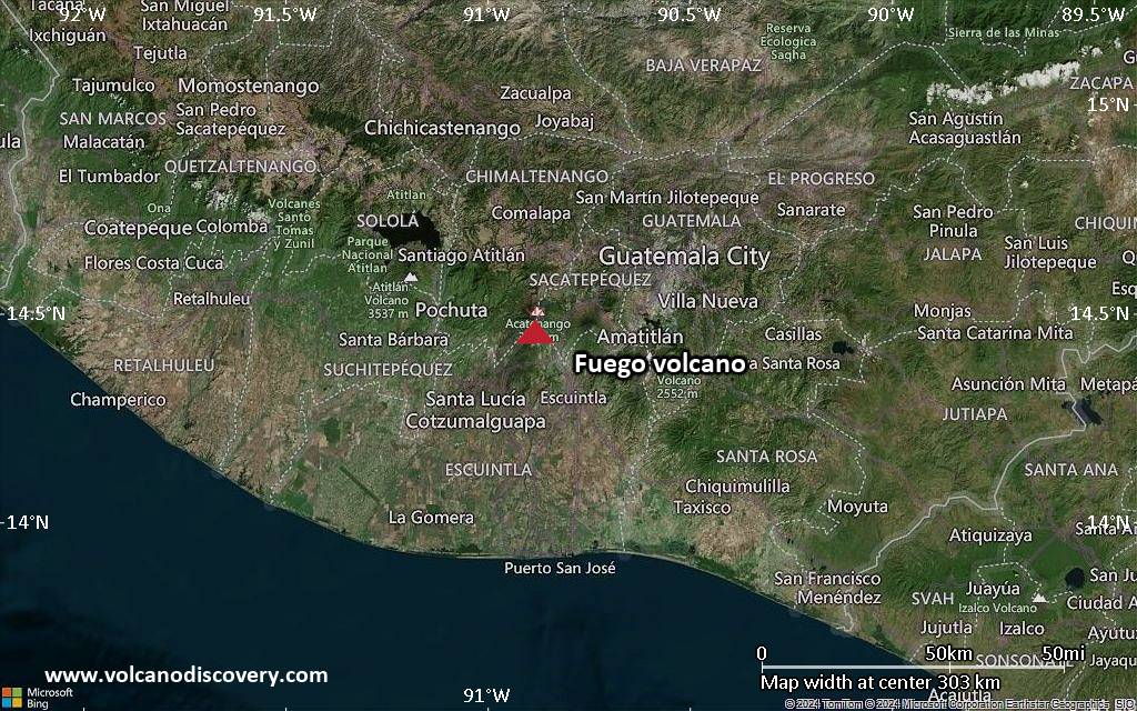
<!–div style="font-size:14px;text-align:center;border:3px solid blue;border-radius:5px;padding:3px;margin:5px;background:#eee"><a href="https://www.volcanoesandearthquakes.com/app/volcano-report.php?volcanoId=25" style="text-decoration:none" target="_blank" rel="noopener noreferrer nofollow" title="Share a volcano (activity) report, submit a photo or other interesting news!” onclick=”window.open(this.href,’Volcano Report’,’status=0,toolbar=0,location=0,directories=0,menubar=0,resizable=1,scrollbars=1,height=500,width=450′);return false”>Send Volcano Report</div–> Complex volcano 2552 m (8,373 ft)
Guatemala, 14.38°N / -90.6°W
Current status: normal or dormant (1 out of 5) Pacaya volcano eruptions:
1360, 1565, 1623(?), 1651, 1655, 1664, 1668, 1671, 1674, 1677(?), 1678, 1690, 1693, 1699, 1717(?), 1760(?), 1775, 1805, 1830(?), 1846, 1885, 1961, 1965, 1970, 1972, 1973, 1976, 1977, 1978, 1980 – May 1998 (intense period of summit activity), 1999-2003, 2004-2010, 2012, 2013, 2014
Typical eruption style
Mildly explosive and effusive (Strombolian activity, lava fountaining, lava flows from the summit crater). Near continuously active the least during the past centuries.

Click this link to continue reading the article on the source website.