RSS feed source: Volcano Discovery.com

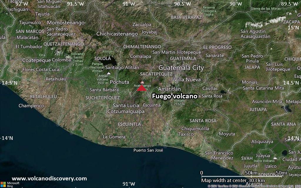
<!–div style="font-size:14px;text-align:center;border:3px solid blue;border-radius:5px;padding:3px;margin:5px;background:#eee"><a href="https://www.volcanoesandearthquakes.com/app/volcano-report.php?volcanoId=26" style="text-decoration:none" target="_blank" rel="noopener noreferrer nofollow" title="Share a volcano (activity) report, submit a photo or other interesting news!” onclick=”window.open(this.href,’Volcano Report’,’status=0,toolbar=0,location=0,directories=0,menubar=0,resizable=1,scrollbars=1,height=500,width=450′);return false”>Send Volcano Report</div–> Stratovolcano 3,763 m / 12,346 ft
Guatemala, 14.47°N / -90.88°W
Current status: erupting (4 out of 5) Fuego volcano eruptions:
1581, 1585, 1586, 1587, 1614, 1617, 1620, 1623, 1629, 1679(?), 1685, 1686, 1689(?), 1699, 1702, 1705, 1706, 1709(?), 1710,1717,1730, 1732, 1737, 1751(?), 1765(?), 1773(?), 1799, 1826, 1829, 1850(?), 1852(?), 1855, 1856, 1857, 1860, 1861(?), 1867(?), 1880, 1896, 1932, 1944, 1949, 1953, 1955, 1957, 1962, 1963, 1966, 1967, 1971, 1973, 1974, 1975, 1977, 1987, 1999, 2002 – ongoing
Typical eruption style
Dominantly explosive, construction of lava domes and extrusion of viscous lava flows. In near constant activity, at least during the past centuries.

Click this link to continue reading the article on the source website.
RSS feed source: Volcano Discovery.com

Support Us – Help Us Enhance Our Services! We’re passionate about delivering the latest volcano and earthquake data from around the globe — just for you. However, maintaining our website and free apps requires significant time, effort, and resources.
Your support helps us expand our hardware and software capabilities and empowers our dedicated editorial team. Our mission is to provide uninterrupted, real-time updates whenever an earthquake strikes or a volcano erupts — and your donations make this possible. Every contribution, big or small, is deeply appreciated. If you find our information valuable and want to help us add new features, create compelling content, and improve our technology, please consider making a donation: Donate with Card or Apple/Google Pay: Donate with PayPal: Planned Features: Improved multilingual support Tsunami alerts Faster responsiveness Thanks to your past donations, we have recently

Click this link to continue reading the article on the source website.

RSS feed source: Volcano Discovery.com

Patchy to areas of fog have developed this morning, especially in and near river valleys across northeast Tennessee into southwest Virginia. Fog may become locally dense, reducing visibility to one-quarter mile or less at times. Motorists should take extra caution for quick drops in visibility. If encountering dense fog be sure to slow down, use low beam headlights, and leave extra space between other commuters.

Click this link to continue reading the article on the source website.

RSS feed source: Volcano Discovery.com

…RED FLAG WARNING REMAINS IN EFFECT FROM NOON TO 9 PM MDT TODAY FOR SCATTERED THUNDERSTORMS FOR FIRE WEATHER ZONES 413 AND 427… * AFFECTED AREA…Fire Weather Zone 413 Caribou Range/Caribou NF and Fire Weather Zone 427 Goose Creek and Raft River Valley/Southern Sawtooth NF/Twin Falls BLM south of the Snake River. * THUNDERSTORMS…25 to 45 percent coverage. * OUTFLOW WINDS…A dry low level environment will promote stronger storms capable of producing wind gusts up to 55 to 60 mph with isolated stronger gusts to 65 mph. * IMPACTS…Critical fire weather conditions are expected Friday afternoon and evening. Lightning may generate new fire starts. Any new fire starts or existing fires

Click this link to continue reading the article on the source website.