RSS feed source: US National Weather Service

SVRABR The National Weather Service in Aberdeen has issued a * Severe Thunderstorm Warning for… Southern Brown County in northeastern South Dakota… * Until 800 AM CDT. * At 715 AM CDT, a severe thunderstorm was located over Bath, or near Aberdeen, moving east at 25 mph. HAZARD…60 mph wind gusts and penny size hail. SOURCE…Radar indicated. At 814 AM, 63 mph wind was reported at the Aberdeen airport. IMPACT…Expect damage to roofs, siding, and trees. * This severe thunderstorm will be near… Groton around 730 AM CDT. Ferney around 735 AM CDT.

Click this link to continue reading the article on the source website.

RSS feed source: US National Weather Service

At 814 AM AST, Doppler radar was tracking a line of strong thunderstorms over Salinas and Cayey, moving northeast at 15 mph. HAZARD…Wind gusts up to 40 mph. SOURCE…Radar indicated. IMPACT…Gusty winds could knock down tree limbs and blow around unsecured objects.

Click this link to continue reading the article on the source website.
RSS feed source: US National Weather Service

* WHAT…Continued flooding caused by overnight excessive rainfall is expected. This Flood Advisory is replacing the Flash Flood Warning that has been in effect. * WHERE…Portions of east central and northeast Illinois, including the following counties, in east central Illinois, Iroquois. In northeast Illinois, Grundy, Kankakee, Kendall and Will. * WHEN…Until 1000 AM CDT. * IMPACTS…Flooding may continue in poor drainage and urban areas. Roads and streets may still be flooded. High water likely may recede slowly from flooded areas. Creeks and streams may rise out of their banks. * ADDITIONAL DETAILS… – At 707 AM CDT, Doppler radar indicated scattered heavy rain producing thunderstorms across portions of the advisory area.

Click this link to continue reading the article on the source website.

RSS feed source: US National Weather Service

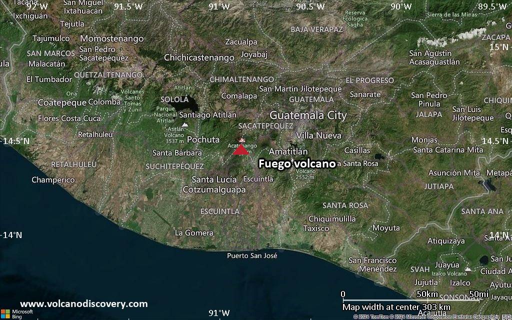
<!–div style="font-size:14px;text-align:center;border:3px solid blue;border-radius:5px;padding:3px;margin:5px;background:#eee"><a href="https://www.volcanoesandearthquakes.com/app/volcano-report.php?volcanoId=26" style="text-decoration:none" target="_blank" rel="noopener noreferrer nofollow" title="Share a volcano (activity) report, submit a photo or other interesting news!” onclick=”window.open(this.href,’Volcano Report’,’status=0,toolbar=0,location=0,directories=0,menubar=0,resizable=1,scrollbars=1,height=500,width=450′);return false”>Send Volcano Report</div–> Stratovolcano 3,763 m / 12,346 ft
Guatemala, 14.47°N / -90.88°W
Current status: erupting (4 out of 5) Fuego volcano eruptions:
1581, 1585, 1586, 1587, 1614, 1617, 1620, 1623, 1629, 1679(?), 1685, 1686, 1689(?), 1699, 1702, 1705, 1706, 1709(?), 1710,1717,1730, 1732, 1737, 1751(?), 1765(?), 1773(?), 1799, 1826, 1829, 1850(?), 1852(?), 1855, 1856, 1857, 1860, 1861(?), 1867(?), 1880, 1896, 1932, 1944, 1949, 1953, 1955, 1957, 1962, 1963, 1966, 1967, 1971, 1973, 1974, 1975, 1977, 1987, 1999, 2002 – ongoing
Typical eruption style
Dominantly explosive, construction of lava domes and extrusion of viscous lava flows. In near constant activity, at least during the past centuries.

Click this link to continue reading the article on the source website.