
On 1/1/2026 6:46:55 AM, an earthquake occurred in Canada potentially affecting Few people affected in MMI&>=IV. The earthquake had Magnitude 5.7M, Depth:9.03km.
Author: WeWorldMedia-admin
![Green earthquake (Magnitude 6M, Depth:10km) in Southeast Indian Ridge 01/01/2026 01:53 UTC, [unknown].](https://resilienceengineeringinstitute.org/wp-content/uploads/2025/12/eq1680050_1.png)
On 1/1/2026 1:53:01 AM, an earthquake occurred in Southeast Indian Ridge potentially affecting [unknown]. The earthquake had Magnitude 6M, Depth:10km.
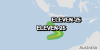
From 31/12/2025 to 31/12/2025, a Tropical Storm (maximum wind speed of 83 km/h) ELEVEN-25 was active in SEIndian. The cyclone affects these countries: Christmas Island (vulnerability Low). Estimated population affected by category 1 (120 km/h) wind speeds or higher is 0 (0 in tropical storm).

On 12/31/2025 2:26:56 PM, an earthquake occurred in Japan potentially affecting 390 thousand in MMI IV. The earthquake had Magnitude 6M, Depth:19.297km.