RSS feed source: Federal Emergency Management Agency

CHICAGO – Preliminary flood risk information and updated Flood Insurance Rate Maps (FIRMs) are available for review by residents and business owners in Fountain County and Incorporated Areas. Property owners are encouraged to review the latest information to learn about local flood risks and potential future flood insurance requirements. Community stakeholders can identify any concerns or questions about the information provided and participate in the 90-day appeal and comment period.

The 90-day appeal period will begin on or around August 28, 2025. The preliminary maps and changes from current maps may be viewed online at the FEMA Flood Map Changes Viewer: http://msc.fema.gov/fmcv.

The updated maps were produced in coordination with local, state and FEMA officials. Significant community review of the maps has already taken place, but before the maps become final, community stakeholders can identify any concerns or questions about the information provided and submit appeals or comments. Contact your local floodplain administrator to do so. 

Appeals must include technical information, such as hydraulic or hydrologic data, to support the claim. Appeals cannot be based on the effects of proposed projects or projects started after the study is in progress. If property owners see incorrect information that does not change the flood hazard information, such as a missing or misspelled road name in the Special Flood Hazard Area or an incorrect corporate boundary, they can submit a

Click this link to continue reading the article on the source website.

RSS feed source: Federal Emergency Management Agency

Volcanoes Today, 28 Aug 2025: Santiaguito volcano, Fuego, Popocatépetl, Semeru, Ibu, Dukono, Sangay, White Island

Thu, 28 Aug 2025, 19:00 1756407604 | BY: VN

Kirishima (Kyushu): Volcanic Ash Advisory Center Tokyo (VAAC) issued the following report: ACTIVITY CONT. VA AT 20250828/1800Z FL070 EXTD N OBS VA DTG:28/1800Z

Sakurajima (Kyushu, Japan): Volcanic Ash Advisory Center Tokyo (VAAC) issued the following report: ERUPTED AT 20250828/1356Z FL110 STNR OBS VA DTG:28/1420Z

Suwanose-jima (Ryukyu Islands): Explosive activity continues. Volcanic Ash Advisory Center (VAAC) Tokyo warned about a volcanic ash plume that rose up to estimated 9000 ft (2700 m) altitude or flight level 090 and is moving at 10 kts in W direction.
The full report is as follows: VA EMISSIONS CONTINUING OBS VA DTG:28/1120Z to 9000 ft (2700 m)

Bagana (Bougainville Island, Papua New Guinea): (27 Aug) Explosive activity continues. Volcanic Ash Advisory Center (VAAC) Darwin warned about a volcanic ash plume that

Click this link to continue reading the article on the source website.
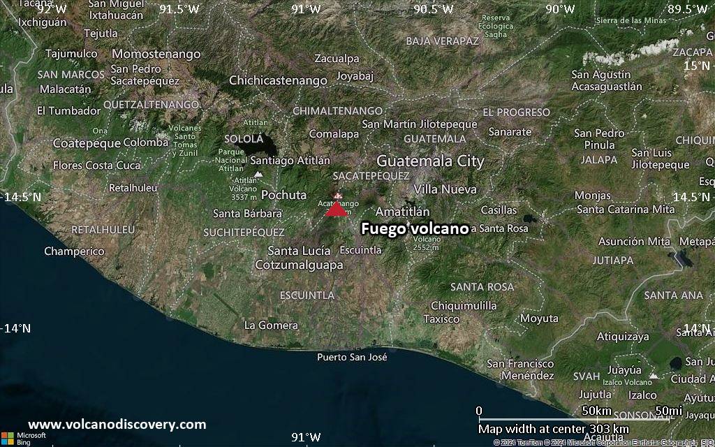
RSS feed source: Federal Emergency Management Agency

<!–div style="font-size:14px;text-align:center;border:3px solid blue;border-radius:5px;padding:3px;margin:5px;background:#eee"><a href="https://www.volcanoesandearthquakes.com/app/volcano-report.php?volcanoId=26" style="text-decoration:none" target="_blank" rel="noopener noreferrer nofollow" title="Share a volcano (activity) report, submit a photo or other interesting news!” onclick=”window.open(this.href,’Volcano Report’,’status=0,toolbar=0,location=0,directories=0,menubar=0,resizable=1,scrollbars=1,height=500,width=450′);return false”>Send Volcano Report</div–> Stratovolcano 3,763 m / 12,346 ft
Guatemala, 14.47°N / -90.88°W
Current status: erupting (4 out of 5) Fuego volcano eruptions:
1581, 1585, 1586, 1587, 1614, 1617, 1620, 1623, 1629, 1679(?), 1685, 1686, 1689(?), 1699, 1702, 1705, 1706, 1709(?), 1710,1717,1730, 1732, 1737, 1751(?), 1765(?), 1773(?), 1799, 1826, 1829, 1850(?), 1852(?), 1855, 1856, 1857, 1860, 1861(?), 1867(?), 1880, 1896, 1932, 1944, 1949, 1953, 1955, 1957, 1962, 1963, 1966, 1967, 1971, 1973, 1974, 1975, 1977, 1987, 1999, 2002 – ongoing
Typical eruption style
Dominantly explosive, construction of lava domes and extrusion of viscous lava flows. In near constant activity, at least during the past centuries.

Click this link to continue reading the article on the source website.

RSS feed source: Federal Emergency Management Agency

<!–div style="font-size:14px;text-align:center;border:3px solid blue;border-radius:5px;padding:3px;margin:5px;background:#eee"><a href="https://www.volcanoesandearthquakes.com/app/volcano-report.php?volcanoId=62" style="text-decoration:none" target="_blank" rel="noopener noreferrer nofollow" title="Share a volcano (activity) report, submit a photo or other interesting news!” onclick=”window.open(this.href,’Volcano Report’,’status=0,toolbar=0,location=0,directories=0,menubar=0,resizable=1,scrollbars=1,height=500,width=450′);return false”>Send Volcano Report</div–> Stratovolcano 2891 m (9,485 ft)
Western Sumatra, Indonesia, -0.39°S / 100.46°E
Current status: erupting (4 out of 5) Marapi volcano eruptions:
2011-ongoing, 2004 (Aug), 2001, 2000, 1999, 1987-94, 1984, 1984, 1983, 1982, 1980, 1975-79, 1973, 1970-71, 1968(?), 1967, 1966, 1958, 1958, 1954-57, 1950-52, 1949, 1949, 1943, 1932, 1930, 1929, 1927, 1925, 1919, 1918, 1918, 1917, 1916, 1915, 1913, 1911, 1910, 1907-08, 1905, 1904, 1889, 1888, 1886, 1885, 1883, 1878(?), 1883, 1876-77, 1876, 1871, 1871, 1863, 1861, 1855-56, 1854, 1845, 1833-34, 1822, 1807, 1770
Typical eruption style
Small to moderate sized explosions

Click this link to continue reading the article on the source website.