RSS feed source: USGS Earthquake Hazards Program
Time2026-10-29 02:18:21 UTC2026-10-29 02:18:21 UTC at epicenterLocation12.948°N 144.582°EDepth70.24 km (43.64 mi)
Click this link to continue reading the article on the source website.
RSS feed source: USGS Earthquake Hazards Program
Time2026-10-29 02:18:21 UTC2026-10-29 02:18:21 UTC at epicenterLocation12.948°N 144.582°EDepth70.24 km (43.64 mi)
Click this link to continue reading the article on the source website.
RSS feed source: USGS Earthquake Hazards Program
Time2026-10-28 07:02:12 UTC2026-10-28 07:02:12 UTC at epicenterLocation30.956°S 65.568°WDepth186.30 km (115.76 mi)
Click this link to continue reading the article on the source website.
RSS feed source: USGS Earthquake Hazards Program
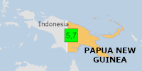
Time2026-10-29 03:26:42 UTC2026-10-29 03:26:42 UTC at epicenterLocation5.699°S 141.902°EDepth10.00 km (6.21 mi)
Click this link to continue reading the article on the source website.
RSS feed source: USGS Earthquake Hazards Program
On 10/29/2026 3:26:42 AM, an earthquake occurred in Papua New Guinea potentially affecting Few people affected (in MMI>=VII). The earthquake had Magnitude 5.7M, Depth:10km.
Click this link to continue reading the article on the source website.