RSS feed source: US National Weather Service

* WHAT…Snow expected. Total snow accumulations between 3 and 6 inches. * WHERE…Portions of west central and western Maine and northern New Hampshire. * WHEN…From 8 AM this morning to 4 AM EST Wednesday. * IMPACTS…A weather system will bring a period of light snowfall to the region. Although snowfall amounts will be light, travel will still be impacted due to snowfall accumulations on untreated roads. Periods of moderate and heavy snow will combine with low visibility to create dangerous driving conditions. The hazardous conditions could impact the evening commute.

Click this link to continue reading the article on the source website.

RSS feed source: US National Weather Service

* WHAT…Heavy snow expected. Total snow accumulations between 4 and 7 inches. * WHERE…Portions of south central and southwest Maine and southern New Hampshire. * WHEN…From 8 AM this morning to 4 AM EST Wednesday. * IMPACTS…A snowstorm will bring plowable snow to the region with a period of moderate travel impacts expected. Periods of moderate snow and low visibility will be the biggest hazards. Heavy wet snow may cause weighted tree limbs, leading to snapped branches. Isolated outages possible. Periods of moderate and heavy snow will combine with low visibility to create dangerous driving conditions. The hazardous conditions could impact the Tuesday morning and evening commutes. * ADDITIONAL DETAILS…It is

Click this link to continue reading the article on the source website.

RSS feed source: US National Weather Service

Support Us – Help Us Enhance Our Services! We’re passionate about delivering the latest volcano and earthquake data from around the globe — just for you. However, maintaining our website and free apps requires significant time, effort, and resources.
Your support helps us expand our hardware and software capabilities and empowers our dedicated editorial team. Our mission is to provide uninterrupted, real-time updates whenever an earthquake strikes or a volcano erupts — and your donations make this possible. Every contribution, big or small, is deeply appreciated. If you find our information valuable and want to help us add new features, create compelling content, and improve our technology, please consider making a donation: Donate with PayPal: Planned Features: Improved multilingual support Tsunami alerts Faster responsiveness Thanks to your past donations, we have recently added: Design upgrades Detailed earthquake

Click this link to continue reading the article on the source website.
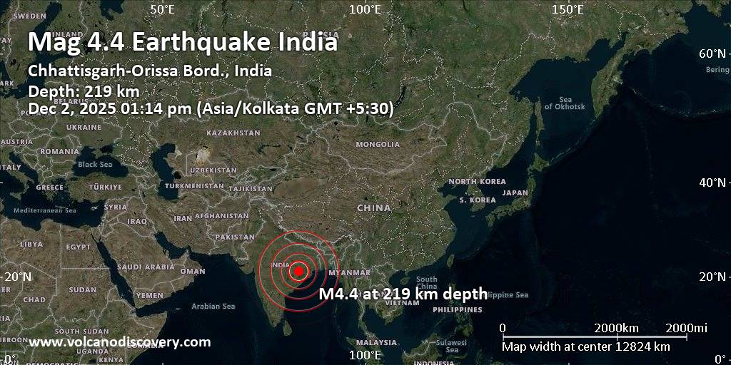
RSS feed source: US National Weather Service

7 km (4 mi)

N of epicenter

Bargarh

(pop: 80,600)

II: Very weak

State of Odisha 10 km (6 mi)

SW of epicenter

Barpali

(pop: 20,900)

II: Very weak

Baragarh, State of Odisha 19 km (12 mi)

SW of epicenter

Bijepur

(pop: 6,920)

II: Very weak

Baragarh, State of Odisha 22 km (14 mi)

NW of epicenter

Bhatli

(pop: 4,870)

II: Very weak

Baragarh, State of Odisha 24 km (15 mi)

W of epicenter

Sohela

(pop: 6,920)

II: Very weak

Baragarh, State of Odisha 34 km (21 mi)

SE of epicenter

Binika

(pop: 15,800)

II: Very weak

Subarnapur, State of Odisha 37 km (23 mi)

NE of epicenter

Burla

(pop: 46,700)

II: Very weak

Sambalpur, State of Odisha 38 km (24 mi)

NE of epicenter

Hirakud

(pop: 30,200)

II: Very weak

Sambalpur, State of Odisha 42 km (26 mi)

NE of epicenter

Sambalpur

(pop: 189,400)

II: Very weak

State of Odisha 47 km (29 mi)

S of epicenter

Loisinga

(pop: 6,220)

II: Very weak

Balangir, State of Odisha 49 km (30 mi)

NW of epicenter

Saria

(pop: 6,930)

II: Very weak

Sarangarh Bilaigarh, Chhattisgarh 50 km (31 mi)

NW of epicenter

Baramkela

(pop: 5,600)

II: Very weak

Sarangarh Bilaigarh, Chhattisgarh 58 km (36 mi)

SE of epicenter

Sonepur

(pop: 20,800)

II: Very

Click this link to continue reading the article on the source website.