RSS feed source: Volcano Discovery.com

<!–div style="font-size:14px;text-align:center;border:3px solid blue;border-radius:5px;padding:3px;margin:5px;background:#eee"><a href="https://www.volcanoesandearthquakes.com/app/volcano-report.php?volcanoId=26" style="text-decoration:none" target="_blank" rel="noopener noreferrer nofollow" title="Share a volcano (activity) report, submit a photo or other interesting news!” onclick=”window.open(this.href,’Volcano Report’,’status=0,toolbar=0,location=0,directories=0,menubar=0,resizable=1,scrollbars=1,height=500,width=450′);return false”>Send Volcano Report</div–> Stratovolcano 3,763 m / 12,346 ft
Guatemala, 14.47°N / -90.88°W
Current status: erupting (4 out of 5) Fuego volcano eruptions:
1581, 1585, 1586, 1587, 1614, 1617, 1620, 1623, 1629, 1679(?), 1685, 1686, 1689(?), 1699, 1702, 1705, 1706, 1709(?), 1710,1717,1730, 1732, 1737, 1751(?), 1765(?), 1773(?), 1799, 1826, 1829, 1850(?), 1852(?), 1855, 1856, 1857, 1860, 1861(?), 1867(?), 1880, 1896, 1932, 1944, 1949, 1953, 1955, 1957, 1962, 1963, 1966, 1967, 1971, 1973, 1974, 1975, 1977, 1987, 1999, 2002 – ongoing
Typical eruption style
Dominantly explosive, construction of lava domes and extrusion of viscous lava flows. In near constant activity, at least during the past centuries.

Click this link to continue reading the article on the source website.

RSS feed source: Volcano Discovery.com

* WHAT…A long period westerly swell will result in an increased risk for sneaker waves and rip currents. Breaking waves of 13 to 18 feet with the highest waves up to 23 feet in favored locations are expected. * WHERE…Pacific Coast beaches. * WHEN…From Thursday afternoon through Friday evening. * IMPACTS…Sneaker waves can unexpectedly run significantly farther up the beach than normal, including over rocks and jetties. Rip currents are typically more frequent and stronger in the vicinity of jetties, inlets, and piers.

Click this link to continue reading the article on the source website.

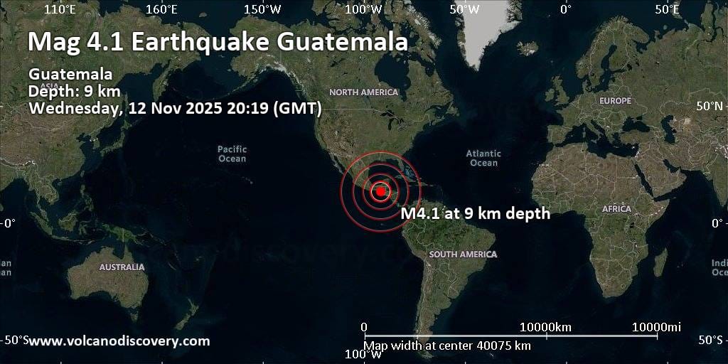
RSS feed source: Volcano Discovery.com

6 km (4 mi)

NW of epicenter

San Sebastian Huehuetenango

(pop: 1,310)

IV: Light

Municipio de San Sebastian Huehuetenango, Departamento de Huehuetenango 12 km (8 mi)

E of epicenter

Huehuetenango

(pop: 79,400)

IV: Light

Departamento de Huehuetenango 18 km (11 mi)

N of epicenter

Todos Santos Cuchumatan

(pop: 3,290)

IV: Light

Municipio de Todos Santos Cuchumatan, Departamento de Huehuetenango 19 km (12 mi)

NW of epicenter

Santiago Chimaltenango

(pop: 3,020)

IV: Light

Departamento de Huehuetenango 20 km (12 mi)

SW of epicenter

San Miguel Ixtahuacan

(pop: 3,660)

III: Weak

Departamento de San Marcos 22 km (13 mi)

W of epicenter

Ixtahuacan

(pop: 3,710)

III: Weak

San Ildefonso Ixtahuacan, Departamento de Huehuetenango 29 km (18 mi)

E of epicenter

Aguacatan

(pop: 5,570)

III: Weak

Municipio de Aguacatan, Departamento de Huehuetenango 31 km (19 mi)

SW of epicenter

Concepcion Tutuapa

(pop: 6,010)

III: Weak

Departamento de San Marcos 31 km (20 mi)

S of epicenter

Cabrican

(pop: 23,000)

III: Weak

Departamento de Quetzaltenango 34 km (21 mi)

SW of epicenter

Comitancillo

(pop: 59,500)

III: Weak

Departamento de San Marcos 36 km (22 mi)

NW of epicenter

La Libertad

(pop: 6,440)

III: Weak

Departamento de Huehuetenango 38 km (24 mi)

NE of epicenter

Soloma

(pop: 49,000)

III: Weak

Departamento de Huehuetenango 38 km

Click this link to continue reading the article on the source website.